If you live in Brisbane and are looking for the ultimate day trip that includes some awesome 4WD tracks, then look no further than Mount Mee.
Table of Contents
HOW TO GET TO BRISBANE’S CLOSEST 4WD TRACKS?
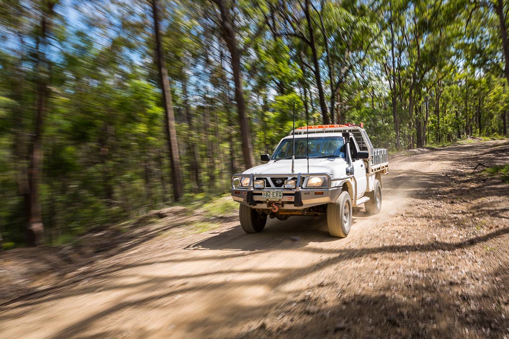
The best thing is, you don’t have to travel far from the centre of Brisbane before you hit the dirt and start exploring this scenic part of the region, and the 4WD tracks it has to offer.
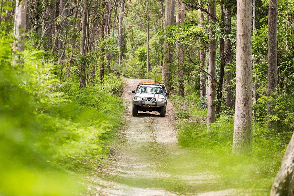
Mount Mee is located within the D’Aguilar National Park (northern section) and is easily one of the closest places to Brisbane to get your fix of local 4WD tracks. Depending on prior weather and your own ability, the tracks range from easy to difficult.
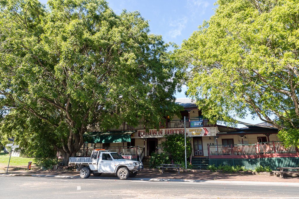
The starting point for this day trip is the little country town of Dayboro, which is located less than 50km from the centre of Brisbane. If you like an early start, grab a tasty treat from the Dayboro Bakery and a coffee from a local cafe. With your belly full, head towards the Crown Hotel and take a right on to McKenzie Street.
DO I NEED A PERMIT FOR MOUNT MEE?
Fortunately, the answer to that is “No.” All you need is a registered 4WD to tackle the dirt tracks of D’Aguilar National Park.
Leaving the bitumen behind, Lacey’s Creek Road winds its way through local grazing lands. Don’t be deterred by the ‘No Through Road’ sign, before crossing a small creek and entering the southern section of the national park.
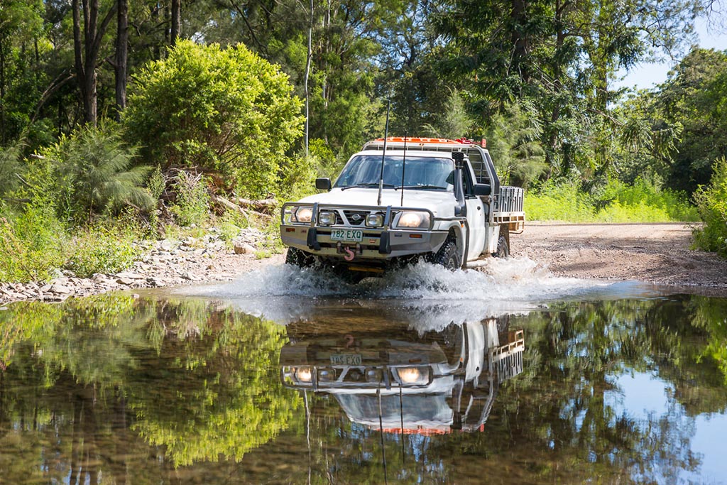
If you are lucky enough to visit after rain, there are a number of crystal clear streams up in the mountains. Park your vehicle up safely and go for an explore around the next corner. Like us, you may just get lucky and find a secret little swimming hole.
Depending on what the recent weather around Brisbane has been like, track conditions will vary greatly. There had been some local rain in the weeks leading up to our visit, however, the eucalypt forest and track conditions were very dry.
It’s always a good idea is to check with the local rangers or visit the website to check for track closures before heading away on your day out exploring.
To minimise track damage, a number of the tracks in the D’Aguilar National Park are gated and will be closed after wet weather.
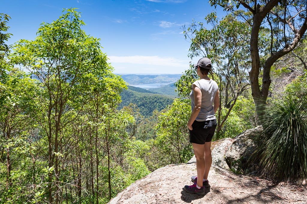
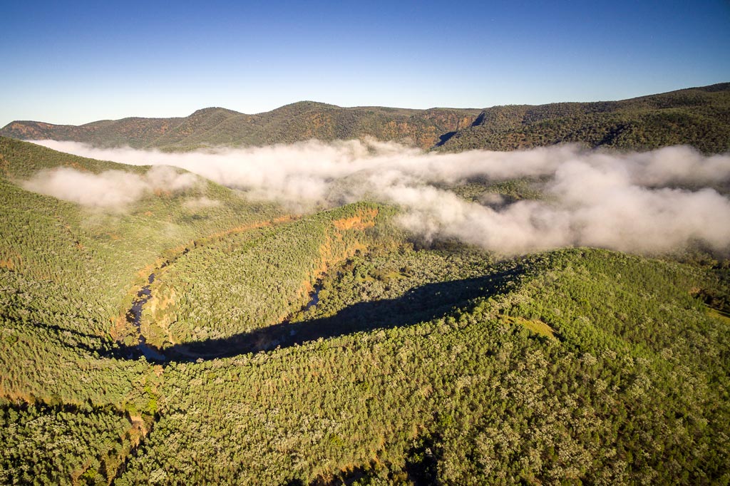
VIEWS TO MORETON BAY
If you’re looking for picturesque mountain views, then you’ve come to the right place.
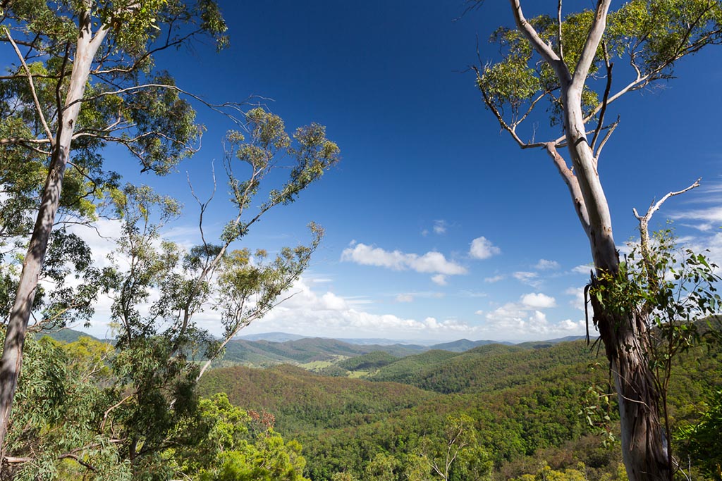
As you continue to climb towards the highest point of the range, there are stunning vistas across the valley to the west. Breaks in the trees provide postcard-worthy views of the lush valleys and rolling peaks of the D’Aguilar Ranges.
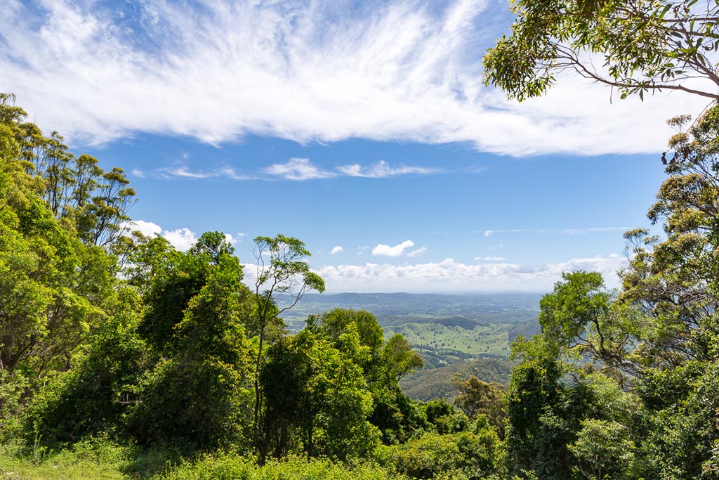
On the eastern side of the range is Kluvers Lookout. With views out to Moreton Bay on a clear day, it’s a great place to stop and break the drive. Boil the billy and have a bite to eat for morning tea while you’re at it.
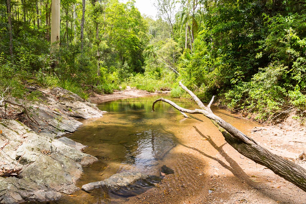
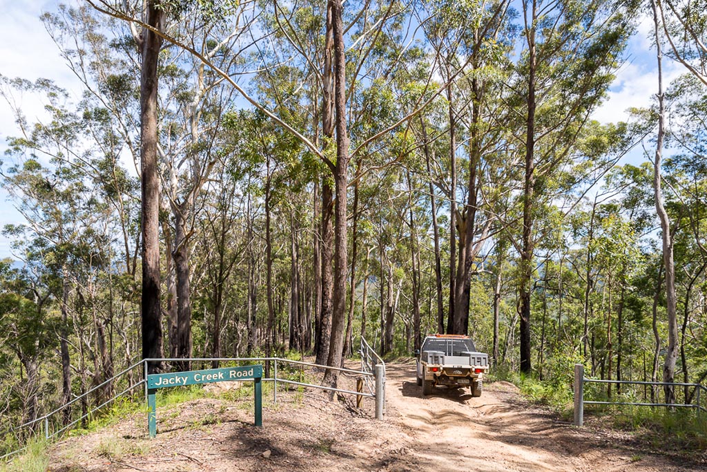
The dry eucalypt forest gives way to subtropical rainforest as you descend towards Byron Creek along Jacky Creek Road. Once again, freshwater streams become a feature of the landscape after recent rainfall.
‘A’ BREAK
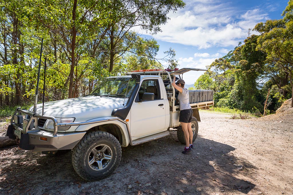
Now that you’ve warmed up and your confidence is growing, it’s time to hit one of the more challenging 4WD tracks in the area.
‘A’ Break climbs out of the lush rainforest around Byron Creek with sections of steep and severely rutted clay. After rain, this is a no go area, and the rangers will often lock the gates at the top and bottom of the track.
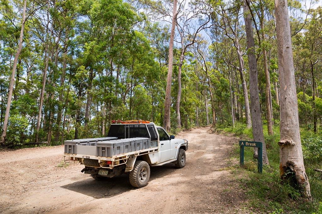
But if you’re up for it, ‘A’ Break will test your ground clearance and low range gearing.
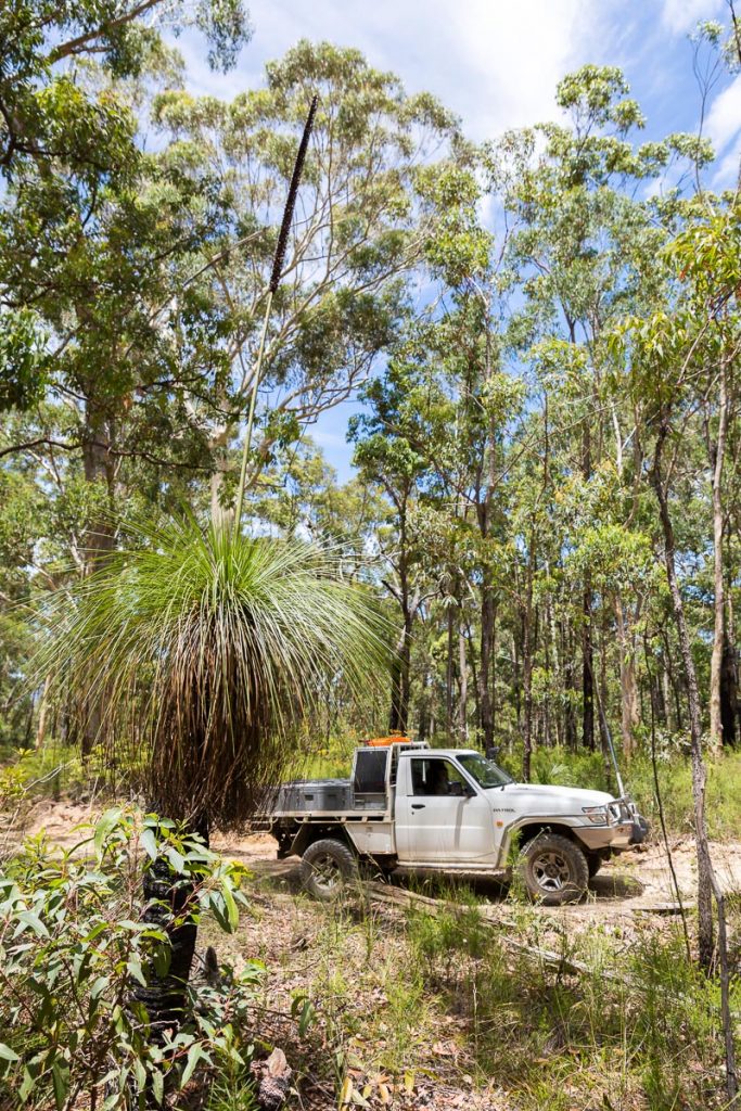
Continuing to climb, the dry, eucalypt forest takes over, and grass trees now dot the surrounding landscape.
GANTRY DAY USE AREA
By the time you’ve made it to the top of ‘A’ Break, you’re not far from The Gantry Day Use Area.
The Gantry was an active sawmill from 1933 until 1981. Producing timber for the Brisbane region, the old sawmill still stands proud at one end of an open, grassy field.
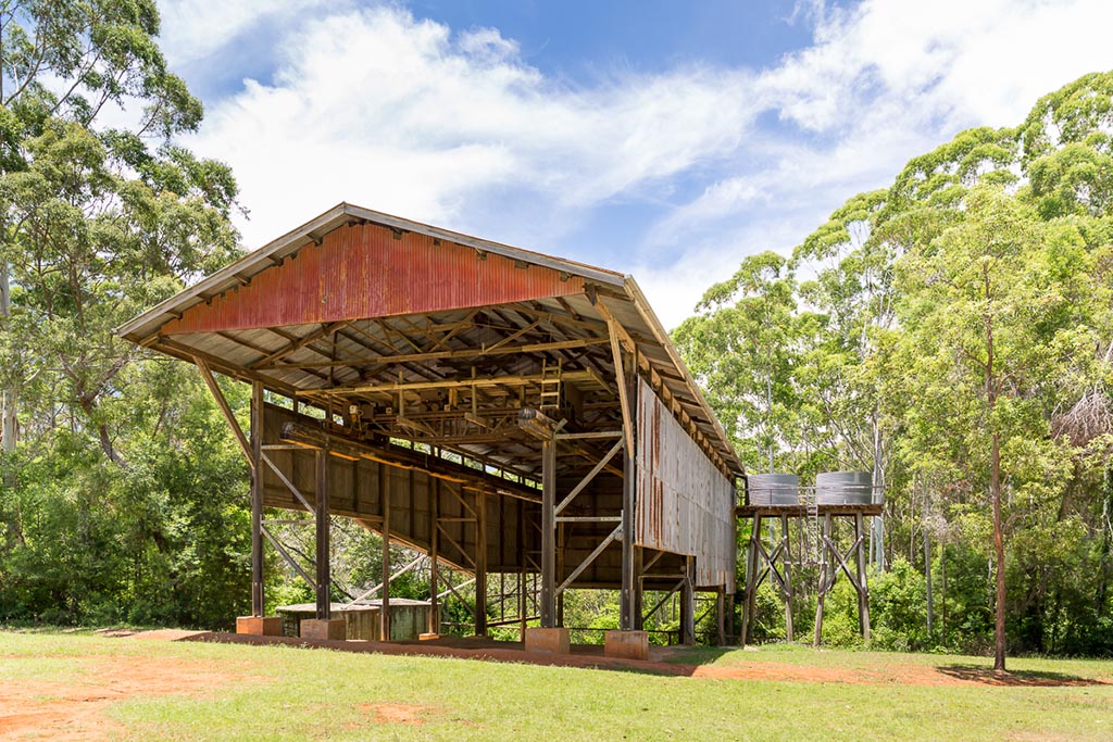
Today, the Gantry is the perfect spot to stop for lunch. Pack a picnic or bring a couple of snags to cook up on the provided BBQ’s. Picnic tables and shelters, toilets and water are also provided as well as a grassed area and plenty of shade.
If you’re feeling energetic, set off on one, or both of the walks that start from the Gantry.
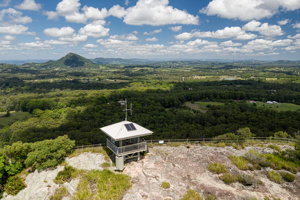
SOMERSET LOOKOUT
Also leaving from the Gantry is the 13km loop along the scenic Western Escarpment Forest Drive.
Partway along the drive, park up your vehicle and take the short walk to the viewing platform at Somerset Lookout.
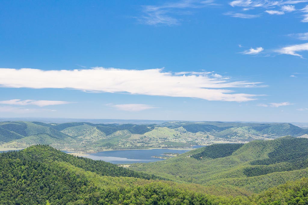
The lookout offers up stunning panoramic views over both Lakes Somerset and Wivenhoe. Grab a selfie as this is one spot worthy of an Instagram share!
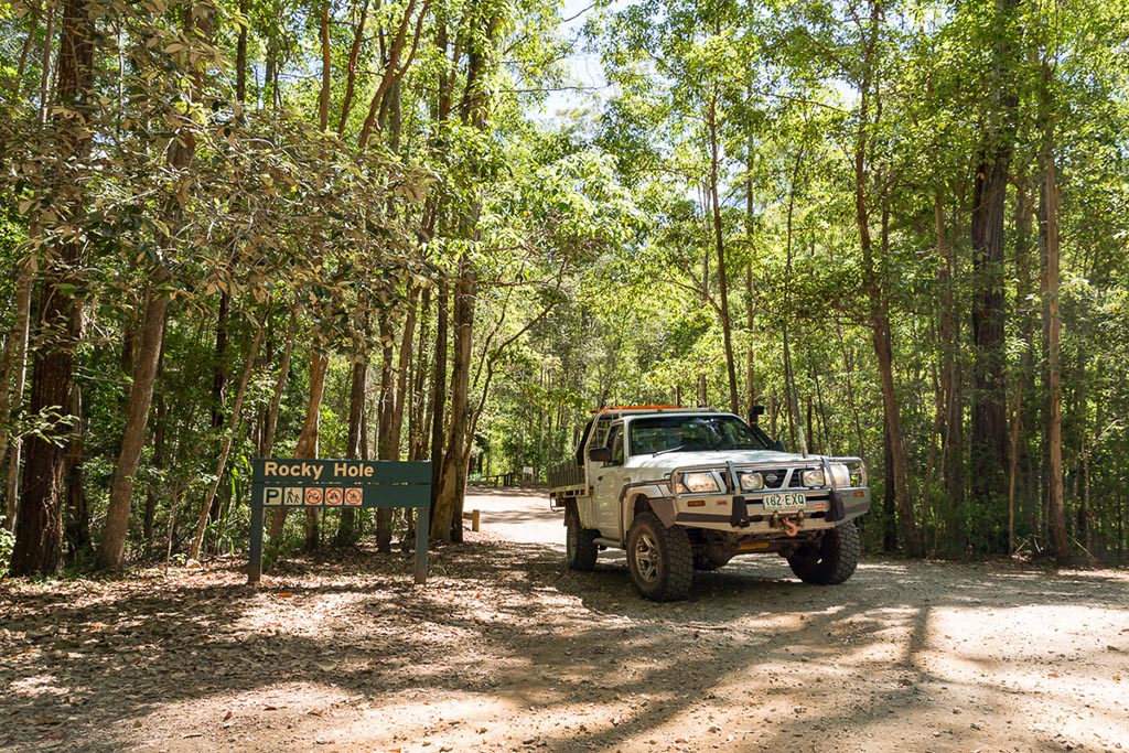
ROCKY HOLE
If the rains have been falling, then a ‘must do’ during summer is a visit to Rocky Hole.
Located a short walk from the parking area, don’t forget to bring your boardies or bikini and enjoy the fresh mountain water. On a hot summer day, this picturesque swimming hole, with its own waterfall is the place to be.
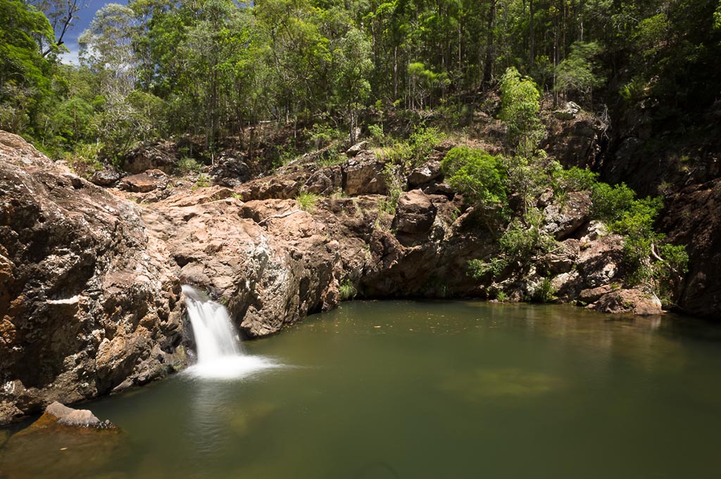
Rocky Hole gets super busy on a weekend, so if you want it all to yourself, a weekday visit may be required.
MOUNT MEE CAMPING
Looking to make this trip to some of the closest 4WD tracks to Brisbane more than just a day trip?
Good news. Within the national park, there are two great campsites to choose from.
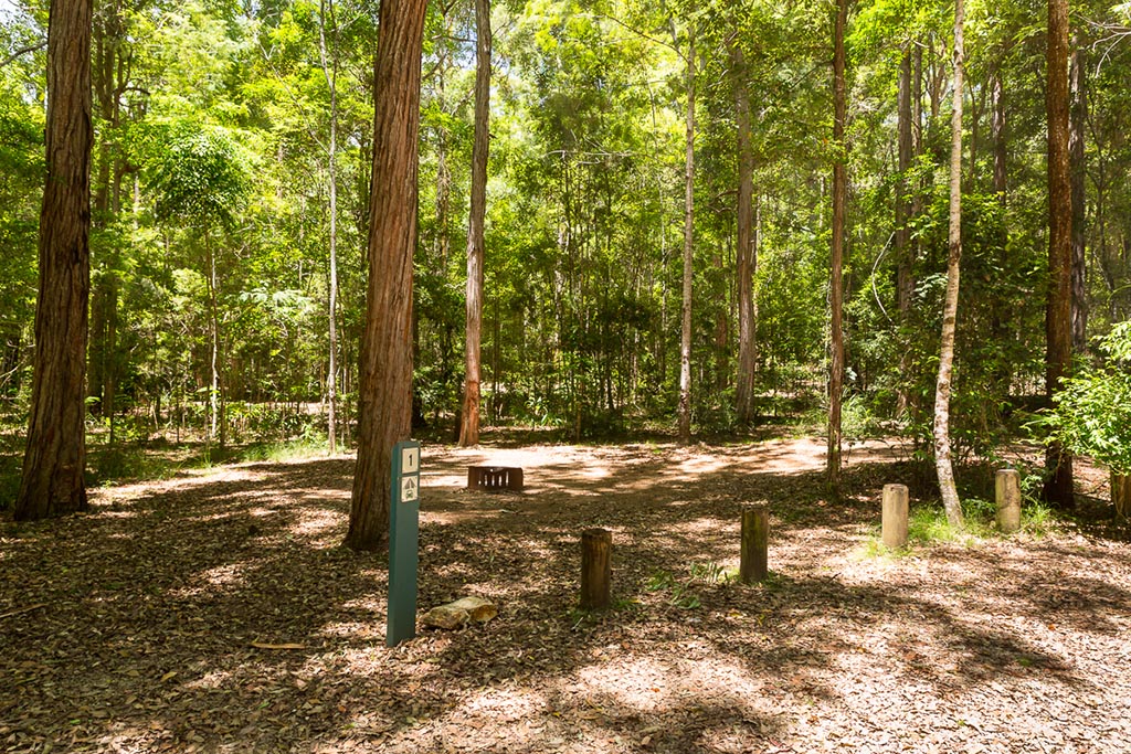
Both Neurum Creek and Archer Camping Areas are located on Neurum Creek. Suitable only for vehicle-based camping, the camping areas offer septic toilets, water (must be boiled before drinking) and fire pits (bring your own wood!). Just make sure you check if any fire bans are in place before striking that match.
Located just outside the boundaries of the park, the privately-owned Neurum Creek Bush Retreat caters for those with camper trailers or caravans. If your four-legged friend also travels with you, they are welcome too.
END OF THE ROAD
By the time you pass the turnoff for Neurum Creek Bush Retreat, the bitumen of the D’Aguilar Highway is not far away.
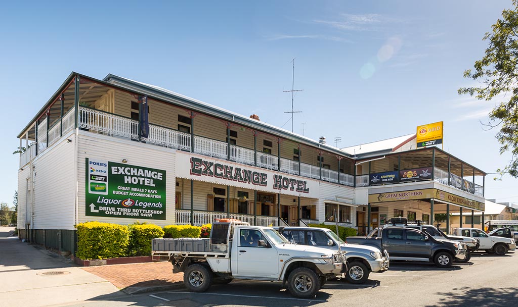
Bonus tip: Head west to Kilcoy for a cold beer and a steak sandwich at the Exchange Hotel in Kilcoy.
Complete a scenic loop back to Brisbane via Somerset Dam and the Esk Valley.
BEST TIME TO VISIT
Without a doubt, the best time to visit Mount Mee is after rain, leaving freshwater in the creeks and increasing the challenge of tracks like ‘A’ Break.
A summer visit will allow you the opportunity to cool off in the waters of Rocky Hole.
Winter gives the added benefit of a chilly morning and a campfire while spending the night in the region.
RESOURCES
These are the resources that we use and recommend while planning our trips:
- Hema Maps – South East Queensland
- HX-1 Hema Navigator GPS
About the Author:
Hi, I’m Matt. I camp, four-wheel drive, explore the outdoors and get paid to take photos.
I’m happiest when I’m doing all four at once.
Occasionally, I’ll even tap out a couple of words on my keyboard.
OTHER POSTS YOU MAY LIKE…
Sunshine Coast Hinterland
While the sun, sand and surf of the Sunshine Coast are the major drawcards, the Sunshine Coast Hinterland towns offer so much to the intrepid traveller. …
Sundown National Park
Rugged and remote are two words that sum up Sundown National Park beautifully. Sundown National Park is a wild and mountainous area…
Jimmy says
Made me want to go for a drive! Never knew what Mt Mee offered!
Matt Williams says
Cheers Jimmy! It is a great spot for a day trip and there’s definitely enough there to occupy a family for a weekend for sure. Have fun! Matt n Mez